by Crystal Cockman
February 13, 2017

A few weeks ago I hiked along the Densons Creek Trail starting at the U.S. Forest Service Ranger station near Troy. You start out on the short loop and jump on the Densons Creek Trail not far in, following white blazes. You pass over Glen Road about 0.8 miles in, and then you have to pay attention to the trail to make sure you go the right way to stay on Densons Creek Trail instead of getting onto a spur trail that doesn’t go anywhere. The trail for most of the way is marked with orange and white paint.
You get to a gravel woods road 1.72 miles in and hike along it for approximately 0.2 miles. There is pretty good signage most of the way, and you’ll want to follow the signs that say they lead back to 24/27. Just past where the trail goes back into the woods off the gravel road, there is a concrete crossing on Densons Creek. We stopped here to take a look, as this is your first sighting of Densons Creek.
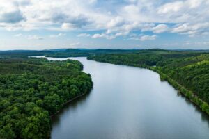
From here, the trail follows Densons Creek, which is a beautiful stream with large rocks and fast moving water. I am sure in the springtime there would be a plethora of lovely streamside wildflowers in bloom along this stretch. There was one footbridge that had been washed away enough to not be of any use, and so we had to scramble down the banks of the small creek and back up to the other side. Trekking poles really help out for crossing creeks.
We got off the trail near the end, as it wasn’t marked clearly, and followed alongside Highway 24/27 in the woods. I stepped in a hole fully up to my knee, but thankfully wasn’t hurt. We were able to connect with Glen Road, and the route planned for going up it anyway to connect back into Densons Creek Trail, so we got back on track there. From there it’s just a little over a quarter of a mile back to the parking lot at the ranger station. Total length of trail is 3.31 miles.
This is a short hike but perfect if you don’t have a lot of time but want to get out in the woods. The topography is not very challenging, but there are a couple of places with some small hills. It might be a good loop to run training for a trail run, as you could make pretty good time on it. It would also be a nice trail to hike in early spring, when the wildflowers are blooming and you might spot some critters along the creek. It will be one I am sure I will visit again.
Distances are courtesy of Don Childrey’s book, Uwharrie Lakes Region Trail Guide, available at donchildrey.com.